Using Technology To Plan My Routes
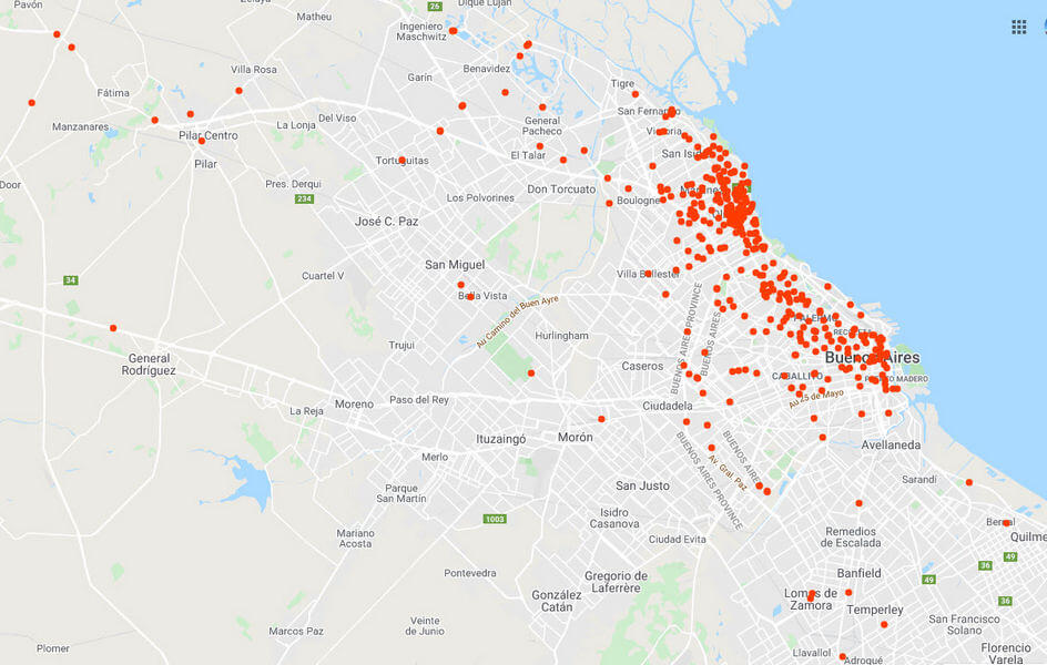
I started my motorcycle courier business a couple of years ago, but it wasn’t until the total lockdown was imposed on 20th March that business went off the chart. Since then, I’ve ridden about 15,000 miles, made around 750 deliveries and collections, and visited hundreds of locations in and around Buenos Aires. During that time I’ve refined my route planning with the help of technology as best I can. More recently I’ve acquired a new customer with regular daily deliveries of between six and ten drops, so route planning has become even more important. I usually receive a list of addresses less than an hour before kick-off which I then feed into Google Maps (in no particular order) and then rearrange logistically. Google Maps has some excellent features for route planning, the most useful being DRAG TO REORDER.

I spent many years as a travelling salesman and I quickly decided that life was easier when I completed the furthest destination first with the remaining calls to be executed on the way home, which is precisely what I do now. Having decided the optimum route on my desktop I then send it to my mobile phone and also take a screenshot which I save to my phone as a quick reference for the order I need to travel in.

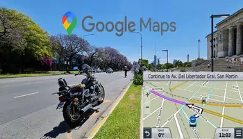
Having planned the route, I then feed all the addresses into the Garmin GPS and after each completed delivery I simply bring up the next destination according to my route planner screenshot. I admit that there’s a doubling up of work in this process and one could ask why I’m not using Google Maps on my phone for the entire process and I agree that it would certainly be simpler. However, I’m constantly referring to my phone for message updates and because it’s such an expensive device, I prefer to keep it hidden in my jacket pocket– opportunistic thieves are everywhere nowadays and if it was stolen, my job would be almost impossible to perform.
Communication On The Road
Without a doubt, the most useful software I use is WhatsApp which allows me to receive destination addresses, Google Maps location links, voice messages, and a host of other information. I realise that WhatsApp isn’t as popular in the US as in many other places, but with so few people now using SMS text message apps, WhatsApp has now become the default messaging service where I live. Furthermore, talking over WhatsApp is free of charge over WiFi and on data, will simply eat into your monthly limit. On the other hand, I’ve had to ask customers NOT to give me address details through voice messages, but through text because a quick glance will tell me everything. Besides, people are in the habit of waffling on and on with voice messages, sometimes for minutes on end which can be tedious.

The Bluetooth communicator on my helmet links up with my phone so that I can talk hands-free and also allows me to listen to music either from my phone or the built-in FM radio. I don’t find this distracting in the least and in very heavy traffic when even my bike can’t get past the cars in front, it helps pass the time. Any speed over about 40 mph, however, is a little noisy for the tiny speakers in my helmet.
Filming My Journeys
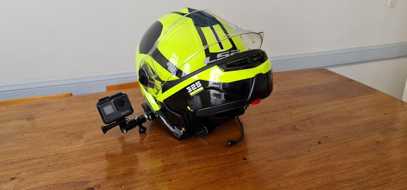
I often forget to attach the GoPro to my helmet when setting off on a delivery run and when something interesting happens, I regret the error. Most habitual V-Loggers will agree that it’s best just to let the camera roll and film everything. You can always edit it later and ditch what you don’t want, which is what I do now. However, since the Hero 5 upwards, there’s no way to record a running commentary through a microphone since there’s no built-in DAC or jack and the external built-in mic is too far from my mouth. Besides, adding a voiceover after the fact lacks the immediacy of the here and now, so I’ve ordered the ridiculously expensive GoPro microphone adaptor to which I’ll attach a mic and conceal somewhere in my helmet if there’s any room left.
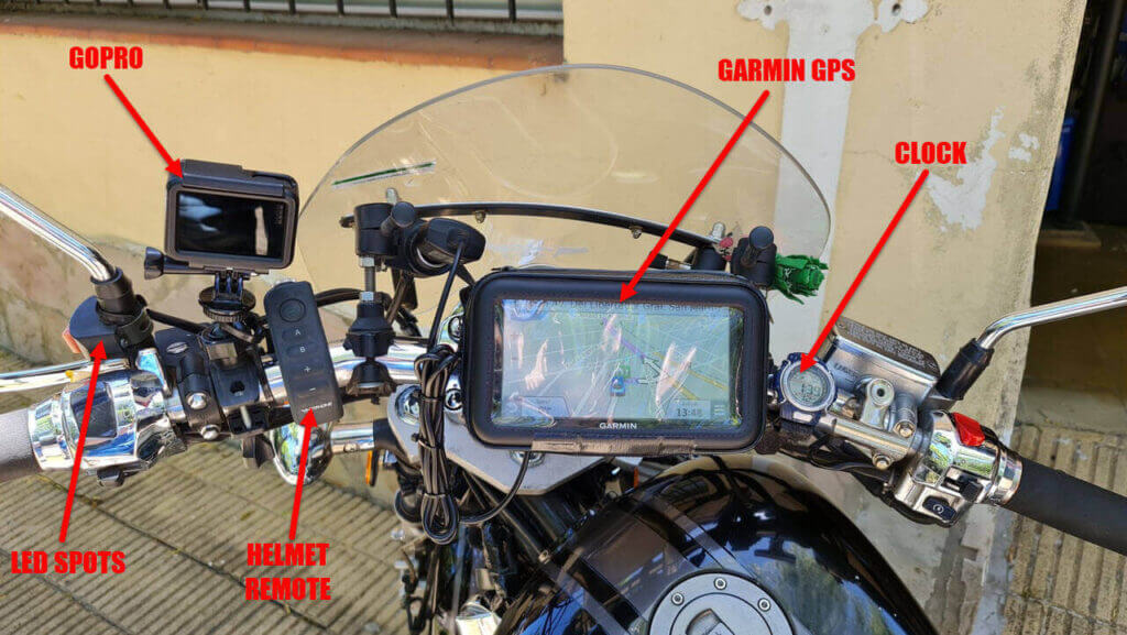
As you can see from the above picture, the GoPro can also be mounted on the handlebars, but this lacks the ‘live’ feel of helmet mounting and excessive vibration can ruin the end result. The Garmin runs off the 12v output and the helmet remote allows me to switch channels and accept calls, whilst the old digital watch that I strapped to the handlebar gives me the time because the Garmin doesn’t show actual time, only arrival time. This is especially important because, in my job, time is currency. Finally, the LED spots are probably my most important safety assets– other drivers see me immediately. Motorcyclists are very often invisible and to counteract that, I make myself as bright as possible.
Would I Ever Use A Paper Map Again?

—